ApliCAD CARTO
ApliCAD CARTO is a general purpose GIS Project Manager designed to facilitate the concurrent management of large volumes of maps from various sources and provide a unified cartographic base for cadastre, urban planning, works, infrastructure, street mapping…
The system manages the tasks of editing and consultation of the cartography from a distributed index database that allows the concurrent management of the project to the group of users.
ApliCAD CARTO has powerful tools to structure the sets of maps in series and cartographic themes and thus facilitate their management. Its index system automates selective searches of text and block attributes to directly locate any toponym or any label of the cartographic set.
ApliCAD CARTO takes advantage of the environment and the powerful tools of AutoCAD MAP/CIVIL, incorporating a working methodology that streamlines the management of map sets that integrate your GIS project.
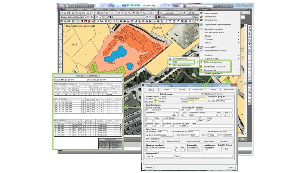
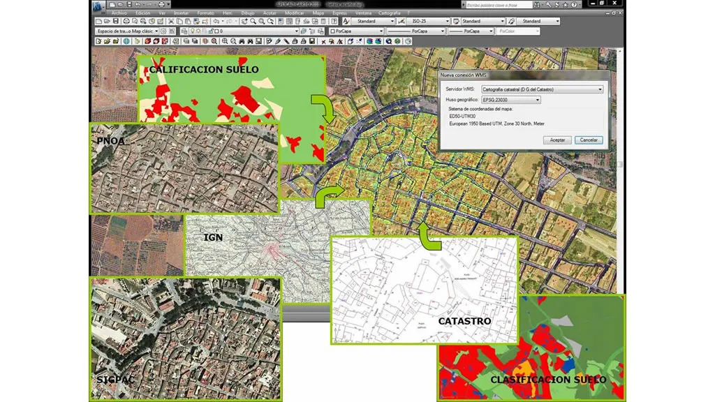
ApliCAD CARTO facilitates the direct integration into your projects of the cadastral parcels of the DGC and provincial maps of CARTOCIUDAD of the IGN, applying styles, optimizing the display ranges and activating search functions by address. Directly integrates BING MAPS interactive cartography, orthophotos and/or vectorial cartography with global coverage into your projects.